The College of Computer, Mathematical, and Natural Sciences hosted a Reddit Ask-Me-Anything spotlighting research on severe weather phenomena.
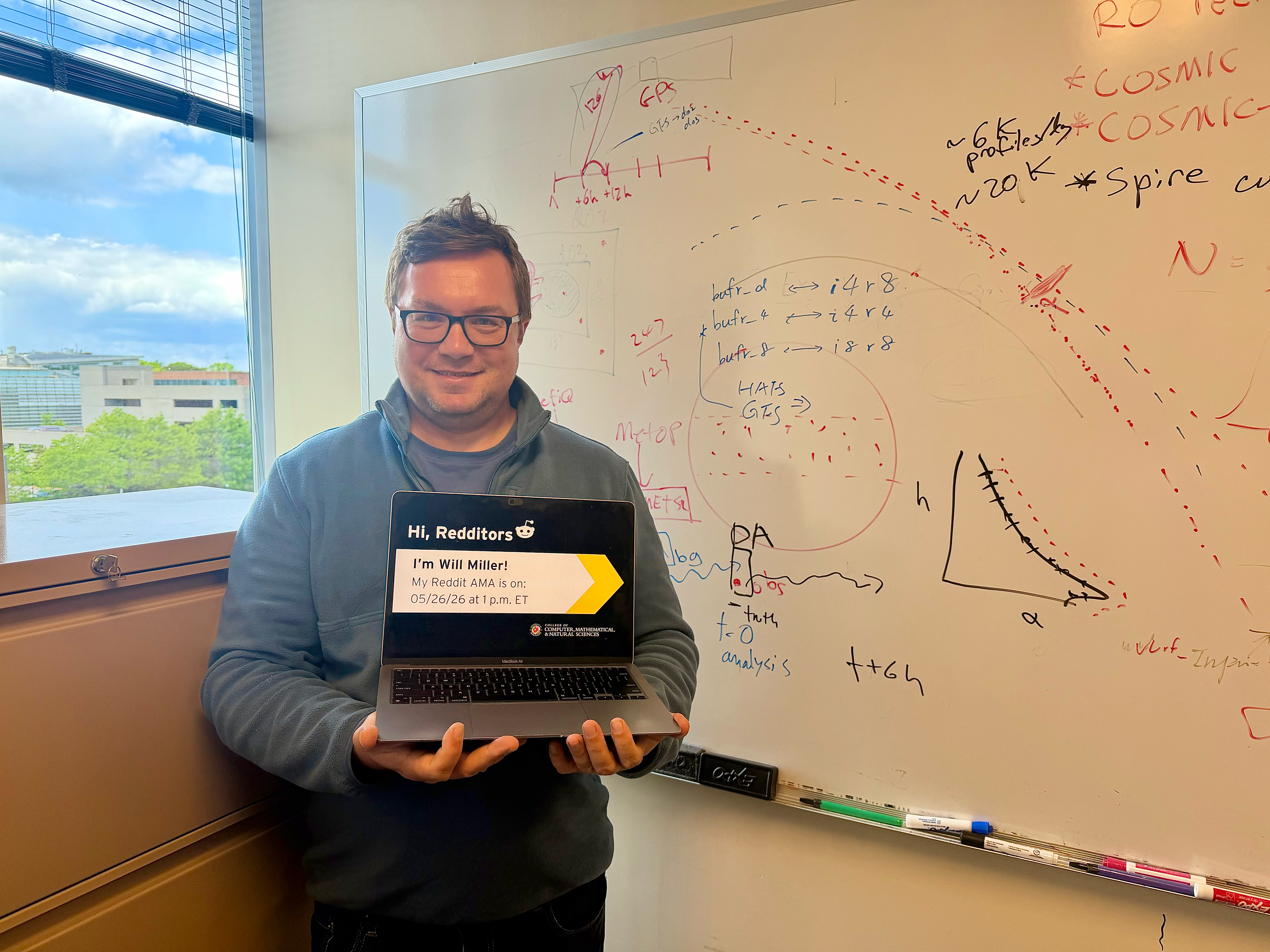
University of Maryland Earth System Science Interdisciplinary Center (ESSIC) Assistant Research Scientist Will Miller participated in an Ask-Me-Anything (AMA) user-led discussion on Reddit to answer questions about tropical cyclones and other severe weather phenomena on May 26, 2026.
Making weather forecasts more accurate gives communities more time to prepare for dangerous weather and make informed decisions about emergency response. Miller’s research focuses on understanding how hurricanes form and behave to improve the accuracy of hurricane forecasts. He studies how temperature, moisture and air currents interact within storms, and how that information can help scientists better predict where hurricanes will go and how strong they will become.
This Reddit AMA has been edited for length and clarity.
If global warming leads to more areas having 'tropical' climates, will that result in more widespread cyclones?
This question is complicated by the fact that tropical cyclones depend not only on sea surface temperatures but also on the stability of the atmosphere to deep vertical motion. To explain simply, more warming in the middle to upper atmosphere than on the ocean surface could suppress tropical cyclone formation in some areas.
Hurricanes act like heat engines, extracting warmth from the ocean waters and exhausting the excess heat in the upper atmosphere, converting some of the heat energy to winds. This mechanism relies on intense vertical motions in the core part of the hurricane, which is why we have to look at both ocean temperatures and upper atmosphere temperatures, and how they change with climate. Rising air is like a buoyant beach ball; it's dependent on the warmth of the air that's rising, but also on the temperature of the surrounding air. And to be buoyant, the rising air needs to be warmer than its surroundings.
This study by Princeton University researchers does, in fact, find increased hurricane frequency in a warmer climate. Most likely, warming of ocean surfaces will result in a higher ceiling in how intense tropical cyclones can become. But there is more uncertainty in climate modeling as to whether the frequency of tropical cyclone activity in general will increase with global warming. That is to say, overall, the danger posed by tropical cyclones to society in a warming world will increase by virtue of the fact that we'll have a higher frequency of higher-end tropical cyclones, and this has been seen in recent years with category-5 cyclones such as Melissa in Jamaica last October and Hurricane Patricia in Mexico in 2015—both of which were record-breaking tropical cyclones relative to history.
Does radio occultation have advantages over passive microwave or infrared profiles for Numerical Weather Prediction (NWP)? If you had to choose between GPS occultation and PMW profiles, both at the same spatial and temporal resolution, which would you choose?
In my view, GPS radio occultation and passive microwave/infrared radiances are complementary, and both are needed for weather prediction. So everyone here is on the same page: computer weather models need to be constrained by observations of the atmosphere, or else, initially small errors in the model physics approximations will grow very large because the atmosphere is a chaotic, fluid system.
The advantages of radio occultation observations are: 1) high vertical resolution on the order of a few hundred meters, 2) relatively unbiased characteristics above the boundary layer, which is the lowest several hundred meters/few kilometers of the atmosphere, and 3) ability to see through clouds and precipitation.
On the other hand, passive microwave and infrared radiation received by satellite instruments orbiting the Earth currently have much wider horizontal coverage, which is very important for getting information over oceans and sparsely populated continental regions. Disadvantages of passive radiation are: 1) low vertical resolution, 2) tendency to be biased due to instrumentation and retrieval algorithms, and 3) assimilating microwave/infrared radiation in numerical models is a complex and still-developing technique, because of the need to reproduce the complex cloud radiation interactions in the model's forward operator (simulating the observation with the model so that the simulated observation and the actual observation can be directly compared in the data assimilation algorithm).
To summarize, both GPS radio occultation and passive microwave/infrared radiation are complementary observations and essential for continual improvement of weather forecasts.
Is there a risk of cyclones starting to form around South America?
There are several reasons why South America is much less prone to tropical cyclones compared with other subtropical/tropical continental shores. Let's take a brief tour around South America for me to try and explain this.
Starting from the Caribbean coast, from Colombia to the Amazon delta in Brazil, that area is protected (relatively speaking) by virtue of being so close to the Equator. You may have heard of the Coriolis force, which is caused by the Earth's rotation and results in large-scale rotation of the atmosphere (counterclockwise in the Northern Hemisphere and clockwise in the Southern Hemisphere). The strength of the Coriolis force increases with poleward movement away from the Equator. The Coriolis force plays a major role in generating the initial spin around an area of thunderstorms in the tropics that can develop into a tropical cyclone. This is why the Caribbean waters close to the South American coast are not favorable genesis regions for tropical cyclones, although further north in the Caribbean, tropical cyclone activity ramps up quickly due to the increased strength of the Coriolis force. Also, the steering winds over the Caribbean tend to blow from east to west, and so it is rare for a storm impacting the Antilles to turn southward and impact the northern coast of South America.
Moving to the Atlantic coast of southeastern Brazil, we have now gained enough latitude for the Coriolis force to be important. However, it is very rare, as you point out, to have tropical cyclones affect southern Brazil—although this has happened on a few rare occasions. To my best knowledge, the reason why tropical cyclone activity is rare here is that the warm water pool extending eastward into the southern tropical Atlantic may not be large enough to support tropical cyclone development. I would need to do a little more research on this topic to give you a better answer, but another possible reason for the lack of tropical cyclone activity off the east-central coastline of South America could be too much vertical wind shear, involving stronger upper-level winds that can act to tear tropical cyclones apart.
Finally, the Pacific coast of South America, south of the Galapagos Islands, along the coasts of Peru and Ecuador, down into Chile, features the cold Humboldt Current (named after the early-19th-century German naturalist who explored South America) that originates in the waters off South America and flows toward the Equator. This water can occasionally warm during El Niño periods (in fact, the name was given by Peruvian fishermen and literally means 'the boy' because they noticed a warming of the waters around late December). However, cold ocean water is not able to evaporate much water vapor into the air, and the atmosphere cannot extract much heat from it. This is also why southern and central California tend to have such dry summers, because there is also a cold current that sets up there during the summer. Because of the cold ocean waters, the subtropical Pacific coast of South America, from Ecuador to northern Chile, cannot support tropical cyclone formation.
Is it just me, or are weather forecasts less accurate this year?
I haven't looked at the statistics for verifying this past year's weather forecast accuracy from any of the major weather models, which forecasters heavily rely on. However, I will say that at least in the eastern U.S., where I live, this spring has been quite a rough ride, swinging between intense heat waves and abnormally chilly weather that has caused a lot of problems with local agriculture.
When does the Gulfstream collapse?
Hopefully not anytime soon! If that happened, Europe would probably revert to the Ice Age as it would lose its source of moderating temperatures. I see no scientific evidence pointing to this happening in the future, but it's a risk we always have to be aware of, because the Earth's climate system is actually very delicate and prone to extreme changes after "tipping points," such as a collapse of the Gulf Stream.
How does volcano eruption with high altitude ashes affect weather forecast, and how does weather forecast affect ash spread forecast?
Volcanic ash has a cooling influence on the climate because it blocks the sun's rays from passing through the atmosphere and warming the Earth. The atmosphere is actually heated from below by radiation and convection, and so anything that reduces the ability of the sun's rays to pass through the atmosphere and warm the Earth's surface will have a cooling impact. One example from history, "The Year Without Summer" in 1816, was caused by the 1815 eruption of Mount Tambora in Indonesia, when average global temperatures dropped by about 0.5 degrees Celsius/1 degree Fahrenheit. It caused frosts to occur in the northeastern U.S. in July and August, with devastating impacts on agriculture.
Do you know anything about the weather anomalies at the Bermuda Triangle?
I can't speak with too much authority on this topic, but I can speculate here and say that one reason why the Bermuda Triangle has historically been feared by seafaring people as a place to travel is that it tends to be home to violent weather systems, including hurricanes. Just so everyone here is on the same page, the Bermuda Triangle is a triangular region over the Atlantic between Florida, Bermuda and Puerto Rico. If you were to draw a heat map with all historical Atlantic hurricane tracks, this region would show up with the highest density. Beyond hurricanes, the Gulf Stream also flows through the Bermuda Triangle, and it tends to spawn stormy weather year-round because of the large amount of heat that the atmosphere can suck out of it, which can power storm systems.
What is the longest/most complex word in your field you enjoy saying?
It may not be the longest and most complex word I can think of in my profession, but I've always enjoyed throwing around the word "frontogenesis" with some friends of mine who are not meteorologists, and they always think I'm talking about some scary weather that's about to happen. In reality, it's a normal process that occurs during even a typical rain or snowstorm. However, it can also be involved in more severe weather and major snowstorms.
What would be different if you had a big continent with a large central ocean, surrounded on all sides by land 50-500 km wide?
The weather that the continent would experience would be dependent on the temperature of that large central ocean. As I mentioned in my previous answer about South America and why the Pacific coast never experiences tropical cyclones, cold water cannot evaporate water vapor very well. Water vapor is essentially the fuel for stormy weather because rising air releases latent heat when the air cools as it rises, which causes all kinds of atmospheric phenomena, including clouds and precipitation.
So if this central ocean were 1/4 the size of the Mediterranean with ocean temperatures like those of the Caribbean, I would expect to see a very wet and stormy climate along the shorelines. However, I am not sure whether an ocean of that size would be large enough to spin up tropical cyclones, since they need some help from the Coriolis force, which acts over large distances (at least 1,000 kilometers). Suppose the land surrounding the central ocean is 500 kilometers wide. The weather impacting areas more distant from the central ocean will depend on what the ocean is like around the outer boundaries. If the water is warm as well, then I would expect that entire continent to have a wet climate. If the water is cold, like it is off the coast of western South America, then those outer land regions may have a rather dry climate. But a lot of the weather experienced by this continent will also be sensitive to terrain, as mountains can create enhanced rainfall as well as rain shadows, depending on which direction the wind is blowing.
What should we expect from El Niño in the southeast this year?
It is possible that the developing El Niño in the tropical Pacific is causing some very chaotic behavior of the Northern Hemisphere Polar Jetstream. El Niños impact our weather in the mid-latitude U.S. through packets of atmospheric wave energy that are emitted by larger thunderstorm complexes over the El Niño-warmed ocean waters in the tropical and eastern Pacific. These energy packets can then hit the Polar Jetstream and cause it to buckle into weather patterns that can cause a variety of impacts, particularly in the wintertime with enhanced precipitation over the southern tier of the United States. But even during the spring and summer, a developing El Niño can cause chaos with the jet stream as it adjusts to these packets of energy coming from the tropics.
I live in Tahiti, and we rarely have tropical cyclones here—except during El Niño seasons. How can we prepare for this upcoming hurricane season?
I can't give you a definitive answer about how strong this upcoming El Niño will be. Longer-range weather prediction is getting further from my area of expertise. But I can say that from what I do know, there is a fair amount of uncertainty in computer model predictions of ocean temperatures and atmospheric flow configurations more than two weeks into the future, so I am not sure.
One reason why tropical cyclones are less frequent where you live in the southeastern Pacific compared to the southwestern Pacific is that the warmest sea surface temperatures are focused in the western part of the basin. And so the waters near Tahiti are not as favorable for tropical cyclone formation, except, as you correctly say, during El Niño years, which slosh the western Pacific warm pool waters further east. This happens as the trade winds, which blow from east to west over the global tropics, weaken during El Niño conditions.
I feel like the South Pacific Ocean region is not well studied in climate research. Do you know why this is?
I agree with you that climate change studies should put more focus on your region, especially given the sensitivity of Pacific islands to sea-level rise. The atmosphere is also less well-sampled with observations over the South Pacific, given the limited land areas and reliance on satellite observations only. In my opinion, GPS radio occultation data and other satellite observations could be particularly beneficial for weather and climate modeling in the South Pacific Ocean region, and I hope that accurate forecasts of future climate change scenarios will help your region better prepare for the future.
Do your computer models run on the NCAR supercomputer Derecho?
No, I run my research experiments on a NOAA supercomputer called HERA, named after the Greek goddess. This computer is used only for research, and the operational models are run on different computers.
I love the name of the NCAR supercomputer you mentioned, though. In my opinion, it is one of the most fascinating (but also dangerous) weather events affecting the U.S. outside of hurricanes.
I just graduated from UMD last week with a minor in planetary science. I love how our campus brings in brilliant folks like yourself from nearby institutions. Do you have any cool project ideas that you think UMD should take a look at putting resources towards from across the university or through partnerships with other institutions?
Thank you for your kind words, and congratulations on your academic achievements! I agree with you that the University of Maryland is a wonderful and unique place, given its strong academics and proximity to Washington, D.C., and a variety of federal agencies.
First of all, there are already many opportunities for UMD's researchers in various science fields to work on collaborative projects with government research labs and explore careers in science policy and management through government connections. Besides the government, the Washington, D.C. area is also home to private companies involved in providing specialized weather forecasting information to clients. Besides the weather business, there are many other opportunities in the private sector in climate change mitigation and other scientific applications.
Just brainstorming here, but one area that I think could be ripe for future interdisciplinary work between the university and government (or the private sector) could be in the interface between weather, climate and the economy/social science. Several groups at the University of Maryland have worked on developing computer models that integrate climate with social science or applications such as crop modeling, and I think that more exciting work can be done in this area. Additionally, communicating extreme weather information in real time or as a longer-term adaptation to climate change would benefit our society.
Are there experiences from your Navy days that you've been able to apply to your research today?
Yes, actually! It's been a while since those days now, but one skill that I had to develop during my years supervising nuclear reactor operations onboard an aircraft carrier was attention to very small details. Nowadays, as a researcher who needs to write and modify others' computer code for analyzing data and providing inputs to the computer models, I have realized how easy it is for a small, careless error to mess up an experiment I've been running for several weeks.
Thankfully, I never experienced any tropical cyclones at sea during my Navy service. I did two deployments; one was in the Mediterranean, and one was in the Arabian Sea, and both were during the summertime. And since my work was all below deck in the engineering plant, I was not even bored by a sunny day and blue sky, and it gave me a new appreciation for the outdoors.
I have a master's in applied physics and worked as a sea ice researcher before enlisting as a naval officer. I am considering re-enlisting as a meteorology officer—would you say this experience allows for opportunities to do a Ph.D. in this field, or would I be better off focusing on something like software/ML engineering instead?
To answer your first question about applying your military experience toward a future career, I would say that the military can prepare you in certain ways for a Ph.D. research career. As I mentioned in a previous answer, my Navy experience managing nuclear plant operations helped train me to be better with attention to detail, which helps a lot when performing research, as a small mistake in setting up an experiment can end up being very costly in "wasted" time and resources. Also, when publishing in scientific journals and writing your dissertation, expect to have to defend your work to peer reviewers and faculty members on your Ph.D. committee, and I think the military can provide some valuable experience, both in attention to detail and in defending your work to others.
I can tell you from my own experience that the Ph.D. route can bring a lot of frustrations and setbacks, as in many fields, the "easy" or "low-hanging fruit" topics have already been solved. And in the United States, federal research funding is not as generous as it was even 10 years ago, when I was in my early years of Ph.D. work. But if you are passionate about the subject and enjoy solving challenging problems, the Ph.D. study can be very rewarding, regardless of whether you choose to pursue an academic career afterwards. I don't have experience working in the private sector in software engineering, but from my broader impression, that career may appeal to someone who prefers building practical products for people to use.
What is the current challenge/question/problem that is bothering you the most as we speak?
I would like to come up with a way to rerun the simulation with perturbed initial conditions to artificially weaken a feature that I hypothesized was important in causing a low-level center to reform close to the mid-level center, which enabled the vortex to align vertically, and then intensification took off after that. I have a paper under peer review right now that presents evidence showing a possible mechanism through which this feature, which is a stationary band of tilted thunderstorms embedded within the core of the developing storm, helped spin up the low-level vortex.
However, it'll be difficult to prove some of these ideas until I can run a sensitivity test that shows how weakening this feature prevents the vortex alignment, and designing these perturbed features is very challenging using a realistic, full-physics computer model such as the WRF-ARW configuration that I use. Some scientists use simpler models to run idealized hurricane simulations, which strip out some complicated physics and allow more direct modification of basic physical processes. Some very important insights have come out of that type of research. However, these models are less realistic.
On the other hand, aircraft radar and satellite observations are the closest we have to atmospheric "truth" about hurricane structure; however, observational data are limited in space and time, and some storm metamorphoses cannot be observed. I view the "full physics modeling" that tries to reproduce real storms such as Joaquin as a middle ground between the idealized simulations and the observations, but one of the drawbacks of my approach is the difficulty in setting up sensitivity experiments that modify the initial conditions without crashing the model.
What is your take on WeatherNext 2? Are data-driven (ML) weather forecasts the future, as opposed to traditional physics-driven NWP?
I can't speak on WeatherNext 2 itself, but based on my own experience comparing ML-based weather prediction models to physics-driven models, I am certainly impressed with their ability to consistently produce forecasts of global weather and hurricane tracks that are comparable (or in some cases, superior) in performance to physics-based models. One thing that I've been very surprised by (I recently attended a roundtable session at a conference on this topic) is the strong performance of ML-based models for hurricane intensity forecasting, given that the ML models are trained on relatively low-resolution computer model data that should struggle to capture the important small-scale physics processes involved in tropical cyclone intensification.
However, in my opinion, physics-based NWP models will have a place for a long time. For one thing, ML-based models are still probabilistic and can occasionally give very unphysical "hallucination" type solutions. Physics-based models will be needed as an independent tool for forecasters to use, and when you see consensus between them and the ML models, that should increase forecast confidence. Back to hurricane intensity forecasting for a moment—despite the impressive performance of ML-based intensity forecasts (such as those provided by Google to NOAA as part of their collaboration), in their current form, the ML models do not provide any information about hurricane structure. They only give you the maximum wind, minimum central pressure, and track forecast. The hurricane size, such as the aerial extent of the damaging winds, is extremely important for forecasting coastal flooding and inland wind impacts that emergency managers need to know about when making decisions. Additionally, the ML-based models, at least in their current form, do not provide any structural "clues" to where the hurricane will be heading in its future intensity pathway. Despite extensive reliance on numerical weather prediction output, human forecasters still play an important role when analyzing observational data and modeling hurricane structures, and they can apply their own knowledge as a backup to the weather forecast models.
What model did you use to study Hurricane Joaquin?
In my Hurricane Joaquin (2015) simulation, I used the WRF-ARW model. My initial conditions were generated from cycling data assimilation over an 18-hour period to try to generate a more realistic high-resolution vortex than what the GFS (Global Forecasting System) model provided in 2015. The GFS provided the boundary conditions, and I used a quadruply nested grid, with a 1km storm-following nest. I used the YSU boundary layer scheme.